Click annotated buttons below to navigate.
(Presented as a public service of the China–Resources.net Web–Site.)
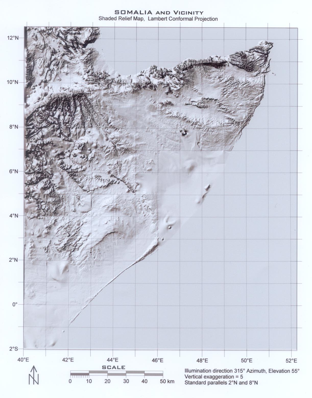
Somalia Region Shaded Relief Images
Version: December 8th, 2025
A compilation of samples of digital shaded relief maps of Somalia, and their effective use in support of anti–terrorist activities, is presented. A free copy of the digital raw enhanced imagery will be sent upon request to any serviceman or -woman in, or on the way to, Afghanistan, whether American or Allied. In the near future, we plan to make these images directly downloadable.
These digital topographic images of areas in, or adjacent to, Somalia are presented as a sample of what can be done using modern technology. As digital images, they can be imported into standard software packages and enlarged. The images listed herein were selected and enhanced by Lee Rice, who has extensive experience with them: These represent only a very small sample of methods by which the available digital elevation models can be enhanced and displayed
Courtesy of Lee R. Rice, P.E., President
Data Technology Services
10920 West Alameda Avenue
Lakewood, CO 80226–2680 USA
303–989–1446 x125 Fax: 303–989–3820
E–Mail: leerice@dtsisoftware.com
Viewers should directly contact the original source to get copies of the original digital data. Detailed instructions for how to do that will soon be incorporated into this document. In the interim, if someone urgently needs a copy, please contact Lindsey V. Maness, Jr. via E–Mail at LVManess@GMail.com for instructions: I can offer expert advice on effective use of the imagery for a variety of purposes. For those involved in the anti–terrorism effort (US or Allied), there will be no charge assessed for routine assistance (i.e., that which does not require a significant expenditure of time or money). For all others, my charge is $200/hour, plus expenses, payable in advance.
Shaded Relief Map from Digital Elevation Models
Scene ID
SRMSOM01.jpg: 1213 wide 1572 high
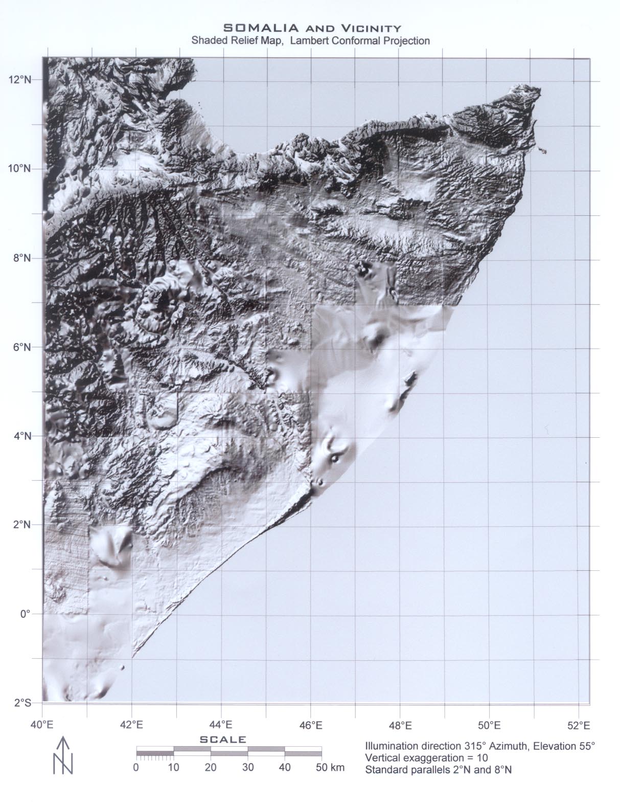
Scene ID
SRMSOM02.jpg: 1213 wide 1572 high